Welcome to DC Metro Map
The DC Metro Map is a simplified schematic detailing Washington, D.C.’s Metrorail system. WMATA runs the system, comprising six color‑coded lines—Red, Blue, Orange, Silver, Yellow, and Green—covering approximately 129 miles and 98 stations. Key transfer points like Metro Center, L’Enfant Plaza, Gallery Place–Chinatown, and Fort Totten allow riders to transfer between lines and travel easily around the city.
Single-line stations are designated with small white circles on the DC Metro Map, and transfer stations are designated with double circles. Overlapping track segments, where two or more lines overlap, are indicated with parallel lines, and dashed lines indicate special service patterns such as rush-hour deviations. Since its inception in 1976, the Metro has expanded to link not just Washington, D.C., but also important areas in Maryland and Virginia. This map is a necessary reference for commuters and tourists alike, guiding them to plan trips, transfers, and routes easily in the region.
Metro Map DC
The metro map DC is a simple, color-coded map of Washington’s six Metrorail lines—Red, Blue, Orange, Silver, Yellow, and Green. Double circles mark transfer hubs such as Metro Center, L’Enfant Plaza, and Gallery Place, and single-line stations are marked with a simple dot. The map further includes shared track segments, termini, and special markers for park-and-ride stations, accessibility, and commuter rail connections such as Amtrak, MARC, and VRE.
Each line runs in different areas, ranging from the Red Line extending to Shady Grove and Glenmont to the Silver Line extending to Dulles Airport and Ashburn. It also connects with the local buses and area transit, so it is an essential tool for smooth travel throughout DC, Maryland, and Virginia. Though it does feel crowded with labels in full traffic areas, the map is a must-have, straightforward resource for traversing the region’s very large metro system.
Washington DC Metro Silver Line Map
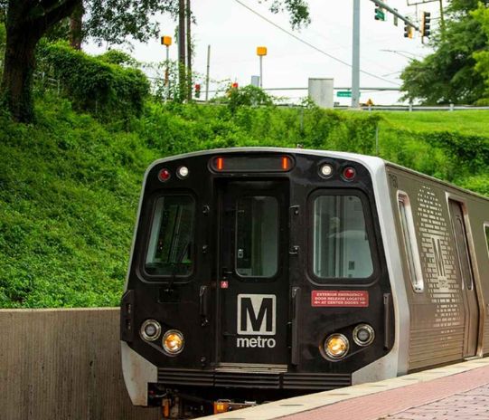
The Silver Line is the newest to join the Washington Metro system, stretching about 41 miles with 39 stations in Northern Virginia, Washington, D.C., and Maryland. It creates a critical transit connection between suburbs such as Reston, Herndon, and Ashburn and the urban core of the District, and gives direct access to Dulles International Airport. The Washington DC Metro Silver Line map represents one of the most dramatic Metro expansions in history. Connecting new suburban communities, an international airport, and current Metro lines, it improves mobility, accessibility, and regional connections while offering an updated, simple-to-read design to riders.
Key Connections and Service
The Silver Line is duplicated on parts of the Orange and Blue Lines east of East Falls Church. It runs through the city center of D.C. and into Maryland, ending at Downtown Largo (previously Largo Town Center). Trains run every 10 minutes in peak hours, 12 minutes off-peak, and 15 minutes late at night.
Features on the Silver Line Map
The Silver Line is demarcated in silver-gray on the Metro system map. The following are marked clearly on the map:
Blue and Orange Line transfer hubs
Dulles Airport link with airport symbol
Park-and-ride lots
ADA-accessible stations
New station names such as “Tysons” (formerly Tysons Corner) and “Downtown Largo” have been added in recent map updates.
Strategic Significance
The Silver Line is vital to regional development, linking primary employment hubs in Reston, Tysons, and Ashburn and providing a long-sought direct rail connection to Dulles Airport. It also pushes Metro out into Loudoun County for the first time, enhancing suburban accessibility and facilitating economic growth.
Maps Metro DC
The Silver Line is the newest addition to the Washington Metro, stretching approximately 41 miles with 39 stops throughout Northern Virginia, Washington, D.C., and Maryland. The Silver Line runs from Ashburn, VA, to Downtown Largo, MD, passing through major districts such as Dulles International Airport, Tysons, Reston, and Herndon and connecting suburban neighborhoods to the city’s center.
Map Design & Connections
The Silver Line is colored silver-gray on Metro maps so it is easily identifiable from other lines. It runs in common track sections with the Orange Line between East Falls Church and Court House, with the Blue Line between Benning Road and Downtown Largo, and coincides with both Blue and Orange lines between Rosslyn and Stadium–Armory. Airport access, park-and-ride facilities, and ADA-accessible stations are also marked on the map to make it easy to get around.

Major Transfer Points
The Silver Line interconnects with other Metro lines at major points such as Rosslyn, L’Enfant Plaza, Metro Center, and Gallery Place, allowing easy transfer between the network.
Operations & Frequency
Trains generally operate every 4–10 minutes at peak times and every 6–15 minutes during off-peak times. This line provides a sorely needed direct rail connection to Dulles Airport and saves commuters time from the suburbs into the heart of Washington.
Significance of the Silver Line Map
The Silver Line map illustrates the Metro’s growth at the regional level, providing improved access to the suburban job hubs and destinations such as Dulles Airport. The map also showcases how the system unifies the new routes with the old ones while maintaining the schematic design simple and rider-friendly.
Map of DC Area Metro
The Washington Metro map is a schematic view of the region’s rapid transit system, with six color-coded lines—Red, Blue, Orange, Yellow, Green, and Silver. It spans approximately 128 miles and 98 stations and serves Washington, D.C., and some areas of Maryland and Virginia. The map is not entirely geographic but harmonizes clarity with rudimentary regional references like rivers, highways, and prominent landmarks.
Shared Tracks and Transfer Hubs
Numerous Metro lines operate on shared tracks for significant segments:
| Lines | Shared Track Segment |
|---|---|
| Blue, Orange, and Silver | Between Stadium–Armory and Rosslyn |
| Orange and Silver | Between East Falls Church and Court House |
| Yellow and Blue | From King Street to Pentagon |
| Yellow and Green | Between L’Enfant Plaza and Fort Totten |
Significant transfer points such as Metro Center, L’Enfant Plaza, and Gallery Place are indicated by double circles to make interchanges readily identifiable.
Connections and Accessibility
The map plots out key transit links, such as Amtrak, MARC, and VRE commuter trains at Union Station, King Street, and New Carrollton. Icons further mark airport proximity (DCA and IAD), park-and-ride lots, and ADA-accessible stations, making it an efficient guide for multimodal travel.
User Experience
The map is universally acclaimed for its simplicity and capacity to display the whole network at once. Nevertheless, some commuters point out that urban centers have the tendency to be congested with overlapping titles, thus becoming more difficult to read. Despite minor criticism, it is an indispensable resource for visitors and commuters alike.
Washington DC Metro Red Line Map
The Red Line is Washington Metro’s longest of six lines, running from Shady Grove in northwest Maryland, through suburbs, and then slicing through downtown Washington, D.C., before terminating at Glenmont. It has 27 stations and is distinctive in that it runs only in Maryland and the District, not into Virginia.
Route Details and Shared Tracks
The Red Line generally follows an old railroad bed from Shady Grove to just north of Takoma. In Washington, it runs underground along principal streets, halting at major points such as Tenleytown, Woodley Park–Zoo/Adams Morgan, Dupont Circle, and Farragut North. Downtown, it serves major nodes like Metro Center, Gallery Place, and Union Station, before continuing into Maryland to Silver Spring, Forest Glen, and finally Glenmont.
Key Stations and Transfer Points
Metro Center links the Red Line to the Blue, Orange, and Silver Lines.
Gallery Place–Chinatown provides transfers to the Green and Yellow Lines.
Fort Totten connects Red, Green, and Yellow Lines.
Union Station is a major transportation hub providing links to Amtrak and MARC commuter trains.
Notable Stops
A few of the notable stations on the Red Line are:
Bethesda, Friendship Heights, and Van Ness–UDC, due to their affluent neighborhoods, stores, and schools.
Woodley Park–Zoo/Adams Morgan, a lively neighborhood known for restaurants, nightlife, and being close to the National Zoo.
Downtown stations such as Dupont Circle, McPherson Square, and Farragut North cover well-used business and cultural hubs.
NoMa–Gallaudet U in Maryland is also noteworthy as the system’s initial elevated infill station, as well as Silver Spring, Forest Glen, and Glenmont.
Infrastructure and Design
Internally, the Red Line has two track routes—Route A (serving Shady Grove) and Route B (serving Glenmont)—which converge at Metro Center. The line uses a combination of surface, elevated, and deep subway sections. The deepest station, Forest Glen, is located almost 200 feet below ground level and is served by high-speed elevators.
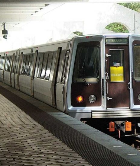
Washington DC Metro System Map
The Metro network comprises six color-coded lines: Red, Blue, Orange, Silver, Green, and Yellow, and is spread over approximately 129 miles with 98 stations. The system operates in a spoke-and-hub pattern, with the lines radiating outward from downtown Washington, serving outer suburban communities in Maryland and Virginia. Approximately 50 miles of track is underground, 46 miles above ground, and 9 miles on elevated tracks.
Key Features
Shared Tracks: Certain Metro lines have shared track segments, enhancing options for transfers and service frequency.
Transfer Stations: Stations like Metro Center, Gallery Place–Chinatown, and L’Enfant Plaza are major transfer points that enable convenient transfers between multiple lines.
Accessibility: All the stations have elevators and escalators, and the majority of them are ADA-accessible, facilitating easy access to passengers with disabilities.
Real-Time Updates: WMATA provides real-time arrivals of trains and buses through digital media such as MetroPulse.
Design and Usability
The Metro map is simplified for clarity and not for precise geographic accuracy. Such a schematic format enables passengers to easily comprehend the overall system layout and plan a journey quickly, even though the distances or directions may not be exactly to scale.
DC Metro Map PDF
Metro system map PDF is an uncluttered and simplified digital design of the Metrorail system, published by the Washington Metropolitan Area Transit Authority (WMATA). It provides a clear-to-read layout of every Metro line, station, and transfer point, assisting residents and visitors alike in navigating the system quickly. WMATA’s website features downloadable PDF maps, the most recent versions with revisions, in standard and large-print size to accommodate diverse requirements. In addition to PDFs, WMATA also offers interactive web maps and trip planners that provide real-time service information and specific route details, which further improve the overall transit experience for users.
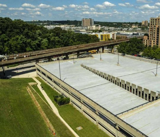
DC Metro Stops Map
The DC Metro stops map is a graphical guide to the Metrorail system operated by WMATA. It indicates the whereabouts of every Metro stop within the six color-coded lines: Red, Blue, Orange, Silver, Green, and Yellow. The map is a valuable tool for both residents and tourists to easily travel using the expansive transit system.
How to Access the Metro Stops Map
WMATA provides PDF versions of the Metro map that contain the following detailed station information:
System Map (Rail): A large map of the whole Metro system, with all lines and stations labeled.
System Map (October 2022 – May 2023): An updated version of the map reflecting changes to the Metro system since October 2022 to May 2023.
The maps come in both regular and large-print versions to suit various needs.
Key Features of the Metro Stops Map
Station Locations: Evident and easy to spot so that riders can easily recognize every Metro stop.
Line Colors: Unique colors are assigned to each Metro line so that recognizing them is easy.
Transfer Stations: Major transfer stations such as Metro Center, Gallery Place–Chinatown, and L’Enfant Plaza are conspicuously marked to allow easy trip planning.
Accessibility: Stations that can accommodate passengers with disabilities are clearly noted to enable accessible travel.
DC Metro Bus Map
The Metrobus system, operated by WMATA, operates in Washington, D.C., and nearby communities in Maryland and Virginia. With more than 250 routes serving nearly 1,500 square miles, it is among the biggest transit bus networks in the United States. In 2023, Metrobus transported approximately 103 million riders a year, averaging around 393,300 passengers each weekday.
Accessing the Metrobus Map
WMATA also provides downloadable PDF copies of the Metrobus map, including all routes and stops. There is an interactive online map available with real-time information and service messages to assist passengers in moving around quickly.
Top Features of the Metrobus Map
Colour-Coded Routes: Bus routes are identified by different colors for quick reference.
Transfer Stations: Major transfer points are depicted clearly to enable passengers to easily transfer between routes.
Accessibility: Information about accessible stops and buses is emphasized to help disabled riders.
Service Frequency: Information about how frequently buses operate on each route is provided, helping with trip planning.
DC Metro Line Map
The DC Metro line map shows the rapid transit system operated by WMATA. It has six color-coded lines—Red, Blue, Orange, Silver, Green, and Yellow—which operate in Washington, D.C., and parts of Maryland and Virginia. Stretching approximately 128 miles and having 98 stations, this vast network is among the busiest in the United States. The map identifies all stations and transfer points like Metro Center, Gallery Place–Chinatown, and L’Enfant Plaza clearly, making it easy for commuters to navigate and chart their journeys. Further, the map also indicates stations that have accessibility features for disabled riders. WMATA has downloadable PDF maps and interactive web maps that contain real-time information and trip planning capabilities, making it simpler for commuters and visitors alike to utilize the system effectively.
DC Metro Blue Line Map
The Blue Line is one of the six rapid transit lines of the Washington Metro transportation system, owned and operated by WMATA. It transports people from all over Washington, D.C., surrounding Maryland, and surrounding Virginia to easily access important neighborhoods, landmarks, and transit centers.
Route and Major Stations
The Blue Line operates between Largo Town Center Station in Maryland and Franconia-Springfield Station in Virginia. In between, it makes stops at significant points like King Street-Old Town in Alexandria, Ronald Reagan Washington National Airport, Pentagon, and some of the central D.C. stations like Metro Center, Smithsonian, and L’Enfant Plaza. The line also makes stops in Prince George’s County, Maryland.
Connections and Transfers
The Blue Line also has shared tracks with the Orange Line between Rosslyn and Stadium-Armory and with the Yellow Line between Pentagon and King Street-Old Town. This enables easy transfers at key stations such as Metro Center (to the Red Line) and L’Enfant Plaza (to the Green Line).
Airport Access
One of the most important attributes of the Blue Line is that it directly connects to Ronald Reagan Washington National Airport through the Reagan National Airport station, thus drawing many travelers.
DC Metro Map Planner
The WMATA DC Metro Trip Planner makes it easy for riders to drive the Metrorail and Metrobus systems. Provided online and as a smartphone app, it offers journey options based on your origin, destination, and time of travel. The planner has real-time information on arrivals, delays, and service adjustments, in addition to fare estimates and available route information. Trips can be tailored to reduce transfers, walking, or travel time, and users can sign up for alerts regarding service changes. It’s a useful tool for commuters as well as tourists to travel easily in the Washington, D.C. region.
DC Metro Orange Line Map
The Orange Line is a principal rapid transit line of the Washington Metro operated by WMATA. The line extends approximately 26.4 miles and has 26 stations in Virginia, Washington, D.C., and Maryland. The line starts from Vienna/Fairfax-GMU in Virginia and terminates at New Carrollton in Maryland, connecting significant neighborhoods, cultural institutions, and commercial districts.
Route and Major Stations
Beginning in Virginia, the Orange Line has stops like Vienna/Fairfax-GMU, Dunn Loring, West Falls Church, and Rosslyn. In Washington, D.C., it has stations like Foggy Bottom-GWU, Metro Center, Smithsonian, and L’Enfant Plaza. Maryland stations on the Orange Line include Minnesota Avenue, Cheverly, and New Carrollton. The Orange Line operates with common tracks with the Blue Line between Rosslyn and Stadium-Armory and with the Silver Line between East Falls Church and Stadium-Armory.
Connections and Transfers
The line provides transfers to other Metro lines at major transfer points such as:
Metro Center (Red Line)
L’Enfant Plaza (Green and Yellow Lines)
Rosslyn (Blue Line)
In addition, riders are able to transfer between Farragut West (Orange Line) and Farragut North (Red Line) stations above ground without additional fare within 30 minutes.
Washington DC Metro Map with Hotels
Traveling Washington, D.C. is easy with the Metro system, and being close to a Metro station can significantly increase your convenience when traveling around the city. There are guides and maps that identify hotels close to Metro stops so that travelers can easily select hotels with easy access to public transportation.
Well-known hotels along major Metro stations are:
| Hotel | Nearby Metro Station(s) |
|---|---|
| Club Quarters Hotel | Farragut West and Farragut North (Blue, Orange, Silver, and Red Lines) |
| Holiday Inn Washington-Capitol | L’Enfant Plaza Station (serving five lines) |
| Grand Hyatt Washington | Metro Center Station (Blue, Orange, Red, and Silver Lines) |
| Kimpton Hotel Monaco DC | Gallery Place-Chinatown Station (Red, Green, and Yellow Lines) |
Washington DC Metro Map with Streets
For a comprehensive view of the Metro system overlaid on a street map, the official WMATA rail map is an invaluable resource. This map provides a detailed layout of the Metro lines, stations, and their relation to the city’s street grid. Additionally, for a more interactive experience, the official WMATA website offers an online trip planner and real-time service alerts, which can be particularly helpful for navigating the system during travel.

