DC Metro Area: Codes, Population, Map, Colleges, Station
The Washington DC Metro Area, more commonly referred to as the “DMV” (District of Columbia, Maryland, Virginia) or National Capital Region, is a vast metropolitan area surrounding the U.S. capital. It includes Washington D.C. itself, as well as many counties and cities in Northern Virginia and portions of Maryland.

Renowned for its strong economy fueled by the federal government, technology, healthcare, and tourism, the region has high salaries and wide-ranging employment. It’s a nexus of historic sites, top-flight museums, and cultural centers, and its vast Metrorail and bus network offers essential transportation, playing a central role in urban development and day-to-day life. Though prosperous, the region is confronted with issues such as housing affordability and an east-west income and racial divide.
You may also like:
Washington DC Metro Area
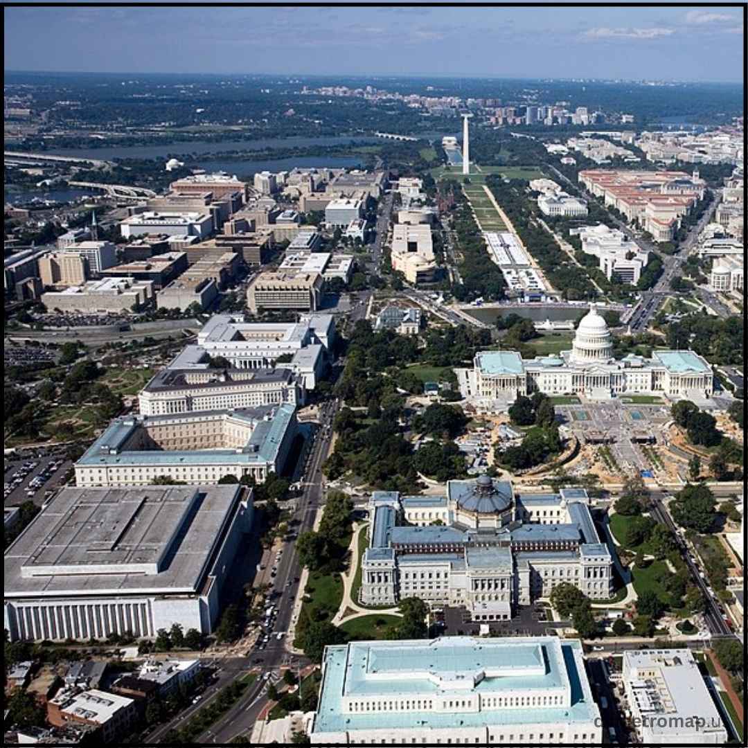
The Washington DC Metro Area, or “DMV,” is a dense urban area with its hub around the U.S. capital, branching into Maryland and Virginia, supporting a 2023 population of 6.3 million and a strong $714.685 billion GDP. The federal government powers its healthy economy, drawing many commuters every day. Established in 1790, D.C.’s unique L’Enfant plan has a grid system of streets crossed by diagonal avenues, emphasising major classical structures such as the Capitol and White House, within a horizontally-extended city due to limits on building height. Aside from its governmental center, the region is a cultural center, with sites of historical interest such as the National Mall and Mount Vernon, and thus is heavily economically significant historically.
DC Metro Area Codes
The Washington D.C. metropolitan community employs several telephone area codes, consistent with its broad geographic coverage throughout the District of Columbia and portions of adjacent Maryland and Virginia.
District of Columbia:
-
202: This was the first DC metro area code designated for Washington, D.C., in 1947 and has been widely associated with the nation’s capital. It serves the entire geographic extent of Washington, D.C.
-
771: Released in April of 2021, 771 is an overlay DC metro area code for the District of Columbia. This signifies that new numbers in D.C. can be assigned either 202 or 771, and ten-digit dialling is now necessary for all calls within the District. This was put into place to meet the growing need for phone numbers.
Maryland:
-
The primary DC metro area codes’ suburbs in Maryland are 301, 240 (an overlay of 301), and the newer 227 (an overlay of 240/301, implemented in June 2023). These cover such areas as Montgomery and Prince George’s counties.
Virginia:
-
Northern Virginia, which is a large portion of the DC metro area, mostly uses 703 and its overlay, 571. Also, outer areas of the larger metropolitan statistical area may use 540 and 826 (an overlay of 540).
Overlay DC metro area codes, like 771 and 240/227 in Maryland, require ten-digit dialling for all local calls in those respective places.
| Area Code | Coverage Area |
|---|---|
| 202 | Washington, DC (District of Columbia) |
| 703 | Northern Virginia (Arlington, Alexandria, Fairfax, parts of Prince William & Loudoun Counties) |
| 571 | Overlay for 703 – Northern Virginia (same regions) |
| 301 | Maryland suburbs of DC (Montgomery County, Prince George’s County, parts of western MD) |
| 240 | Overlay for 301 – Maryland suburbs of DC (same regions) |
Map of the DC Area Metro
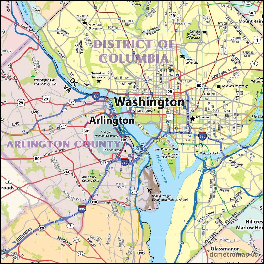
The Washington D.C. Metrorail, or “Metro,” is a vast rapid transit system with six colour-coded lines: Red, Orange, Silver, Blue, Yellow, and Green. WMATA operates it and links D.C. with Maryland and Virginia suburbs, covering 98 stations along 129 miles. Transfer points are noted on the map, and stations are marked with an “M” logo and line-colored stripes. Though mostly underground in the cities, there are sections elevated or near surface level. The design of the system focuses on easy-to-follow navigation, which benefits both commuters and tourists.

Population of the DC Metro Area
The Washington metropolitan area, also called the National Capital Region or DMV (District of Columbia, Maryland, Virginia, and portions of West Virginia), is one of the United States’ most highly populated and prosperous Dc metro areas. As of 2023, its total population estimate is 6,304,975, ranking it as the seventh-most populous metropolitan region in the country. It is also noted as one of the most educated metropolitan regions in the country.
| DC Metro Area | Population | Percentage |
|---|---|---|
| Virginia | 3,077,537 | 48% |
| Maryland | 2,560,379 | 40% |
| Washington, D.C. | 689,545 | 11% |
| West Virginia | 57,701 | 1% |
Hospitals in DC Metro Area
Washington D.C., Maryland and Virginia are lucky enough to have some of the best hospitals in the nation in the DC Metro area, providing high-quality health care for years. Major facilities include MedStar Washington Hospital Center, among the largest in the region and George Washington University Hospital, a center for advanced emergency and trauma care. These hospitals include Howard University Hospital, which focuses on education, and Children’s National Hospital, which specializes in pediatrics.
Coalition hospitals around them include Inova Fairfax Hospital and Suburban Hospital (Johns Hopkins Medicine) in upscale Maryland and Virginia, where top-90% hospitals surround them. As local hospitals and regional medical centers, we balance state-of-the-art technology and the expertise of our physicians—all in one place with care designed to be accessible for both residents and visitors in the DC Metro.
Colleges in the Washington DC Metro Area
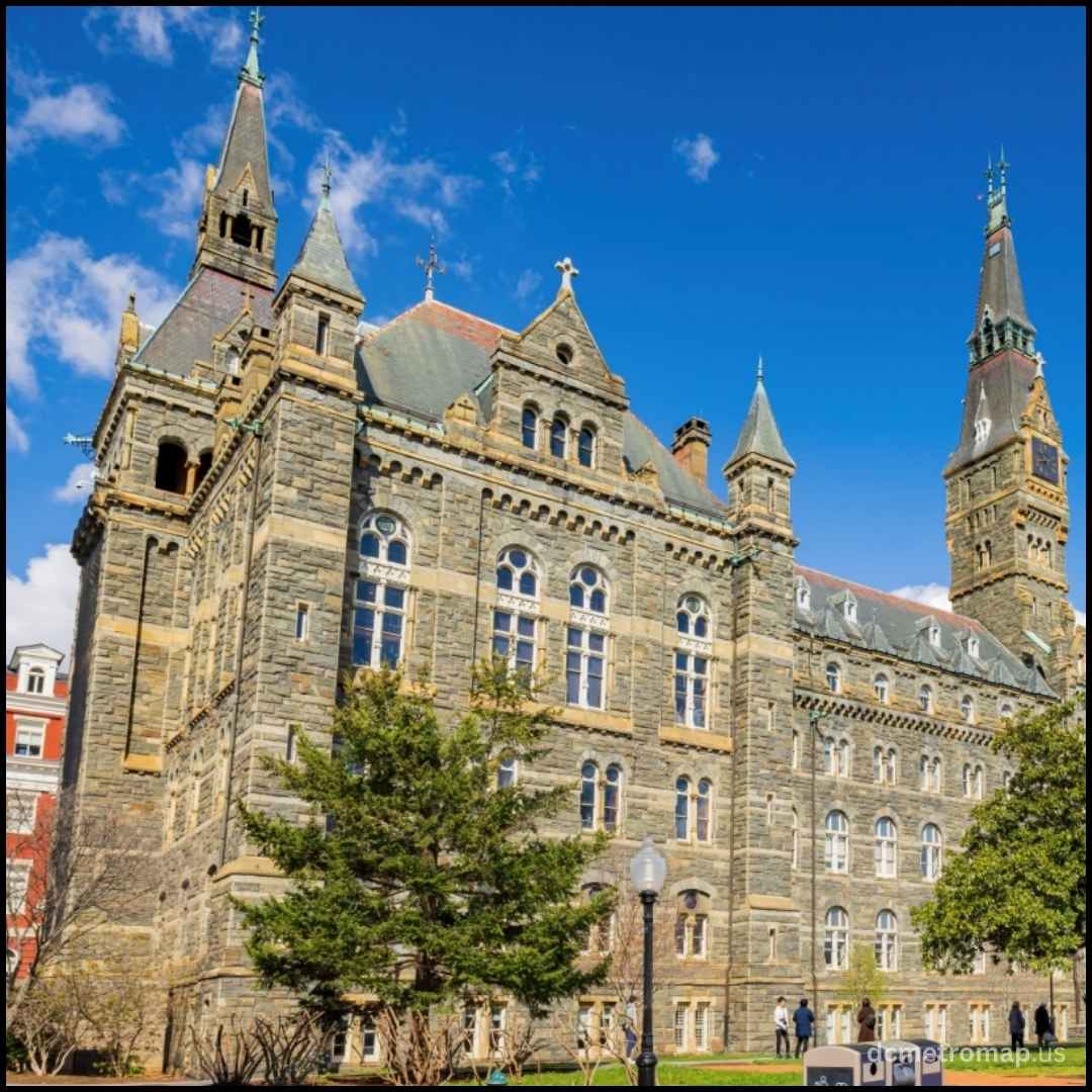
The Washington DC Metro Area is home to a diverse array of colleges and universities, ranging from large research universities to specialised institutions, attracting students from around the world and fueling the region’s educational and economic success. Strong programs include international relations, law, public policy, and journalism.

| School Name | Control | Location |
|---|---|---|
| American University | Private not-for-profit | Washington, D.C. |
| Bay Atlantic University | Private not-for-profit | Washington, D.C. |
| Bowie State University | Public | Bowie, MD |
| Catholic University of America | Private not-for-profit | Washington, D.C. |
| Chamberlain University – Tyson’s Corner | Private for-profit | Vienna, VA |
| Christendom College | Private not-for-profit | Front Royal, VA |
| Gallaudet University | Private not-for-profit | Washington, D.C. |
| George Mason University | Public | Fairfax, VA |
| George Washington University | Private not-for-profit | Washington, D.C. |
| Georgetown University | Private not-for-profit | Washington, D.C. |
| Hood College | Private not-for-profit | Frederick, MD |
| Howard University | Private not-for-profit | Washington, D.C. |
| Institute of World Politics | Private not-for-profit | Washington, D.C. |
| Johns Hopkins University (DC Campus/SAIS) | Private not-for-profit | Washington, D.C. |
| Marymount University | Private not-for-profit | Arlington, VA |
| Montgomery College | Public | Montgomery County, MD |
| National Defence University | Public (U.S. Government) | Washington, D.C. |
| National Intelligence University | Public (U.S. Government) | Washington, D.C. |
| NewU University | Private not-for-profit | Washington, D.C. |
| Northern Virginia Community College | Public | Annandale, VA |
| Prince George’s Community College | Public | Largo, MD |
| Strayer University–District of Columbia | Private for-profit | Washington, D.C. |
| Trinity Washington University | Private not-for-profit | Washington, D.C. |
| University of Maryland – College Park | Public | College Park, MD |
| University of Maryland Global Campus | Public | Adelphi, MD |
| University of the District of Columbia | Public | Washington, D.C. |
| University of the Potomac–Washington DC Campus | Private for-profit | Washington, D.C. |
| Washington Adventist University | Private not-for-profit | Takoma Park, MD |
| Wesley Theological Seminary | Private not-for-profit | Washington, D.C. |
DC Area Metro Stations
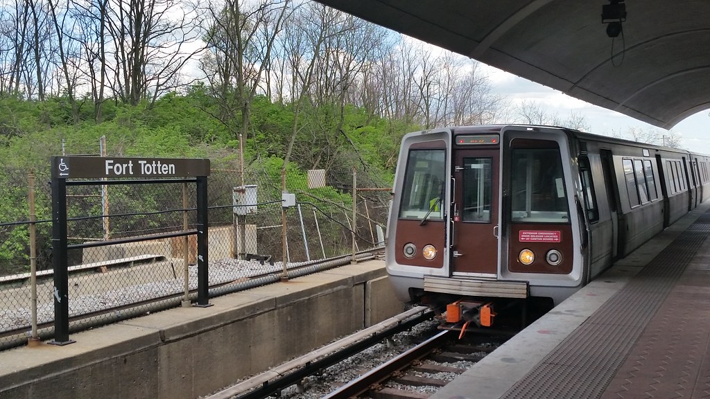
The Metrorail system is run by the Washington Metropolitan Area Transit Authority (WMATA) and serves D.C. and its suburbs. It has six colour-coded lines—Red, Orange, Silver, Blue, Yellow, and Green—travelling through residential neighbourhoods, business areas, government facilities, and popular attractions. A majority of the stations serve as major transfer points, like the Metro Center links four lines (Red, Orange, Silver, Blue), and L’Enfant Plaza provides links to five. The majority of underground stations have a brutalist architectural style with vaulted ceilings, and entrances are denoted by brown pylons with the “M” logo and colored line bands.

| Station Name | Lines Serviced | Location |
|---|---|---|
| Archives-Navy Memorial-Penn Quarter | Green Line, Yellow Line | NW, Washington, DC |
| Brookland-CUA | Red Line | NE, Washington, DC |
| Capitol South | Orange Line, Silver Line, Blue Line | SE, Washington, DC |
| Cleveland Park | Red Line | NW, Washington, DC |
| Columbia Heights | Green Line | NW, Washington, DC |
| Congress Heights | Green Line | SE, Washington, DC |
| Deanwood | Orange Line | NE, Washington, DC |
| Dupont Circle | Red Line | NW, Washington, DC |
| Eastern Market | Orange Line, Silver Line, Blue Line | SE, Washington, DC |
| Farragut North | Red Line | NW, Washington, DC |
| Farragut West | Orange Line, Silver Line, Blue Line | NW, Washington, DC |
| Federal Centre SW | Orange Line, Silver Line, Blue Line | SW, Washington, DC |
| Federal Triangle | Orange Line, Silver Line, Blue Line | NW, Washington, DC |
| Foggy Bottom-GWU | Orange Line, Silver Line, Blue Line | NW, Washington, DC |
| Fort Totten | Green Line, Red Line | NE, Washington, DC |
| Friendship Heights | Red Line | NW, Washington, DC |
| Gallery Pl-Chinatown | Green Line, Yellow Line, Red Line | NW, Washington, DC |
| Georgia Ave-Petworth | Green Line | NW, Washington, DC |
| Judiciary Square | Red Line | NW, Washington, DC |
| L’Enfant Plaza | Orange Line, Silver Line, Blue, Yellow, Green | SW, Washington, DC |
| McPherson Square | Orange Line, Silver Line, Blue Line | NW, Washington, DC |
| Metro Center | Red Line, Orange Line, Silver Line, Blue | NW, Washington, DC |
| Minnesota Ave | Orange Line | NE, Washington, DC |
| Mt Vernon Sq 7th St-Convention Centre | Green Line, Yellow Line | NW, Washington, DC |
| Navy Yard-Ballpark | Green Line | SE, Washington, DC |
| NoMa-Gallaudet U | Red Line | NE, Washington, DC |
| Potomac Ave | Orange Line, Silver Line, Blue Line | SE, Washington, DC |
| Rhode Island Ave-Brentwood | Red Line | NE, Washington, DC |
| Shaw-Howard U | Green Line | NW, Washington, DC |
| Smithsonian | Orange Line, Silver Line, Blue Line | SW, Washington, DC |
| Stadium-Armory | Orange Line, Silver Line, Blue Line | SE, Washington, DC |
| Takoma | Red Line | NW, Washington, DC |
| Tenleytown-AU | Red Line | NW, Washington, DC |
| U Street/African-Amer Civil War Mem/Cardozo | Green Line | NW, Washington, DC |
| Union Station | Red Line | NE, Washington, DC |
| Van Ness-UDC | Red Line | NW, Washington, DC |
| Waterfront | Green Line | SW, Washington, DC |
| Woodley Park-Zoo/Adams Morgan | Red Line | NW, Washington, DC |
Airports in DC Metro Area
| Airport | Code | Distance from DC Center / Location | Metro Connection | Notes on Access |
|---|---|---|---|---|
| Ronald Reagan Washington National Airport (DCA) | DCA | Arlington, VA — very close to downtown DC | Blue & Yellow Lines at “National Airport” station directly connected to Terminal 2 | Terminal-to-station walk via bridges; also served by shuttles from Terminal 1. |
| Washington Dulles International Airport (IAD) | IAD | Dulles, VA — about 25–30 miles west of DC | Silver Line station at “Dulles International Airport” | Station is connected to the terminal via pedestrian tunnel with moving sidewalks. |
| Baltimore/Washington International Thurgood Marshall Airport (BWI) | BWI | Anne Arundel County, MD — ~30 miles northeast of DC | No direct Metro service | Access via MARC or Amtrak trains to Union Station, then Metro / other transit. |
Frequently Asked Questions
1. What are the employment opportunities in the Washington, DC metropolitan area?
The Washington, DC metropolitan area provides a range of job opportunities from fields such as government, healthcare, technology, education, and non-profit. Although federal job postings have diminished in recent times, positions in consulting, research, and administration are widely available.
2. What are the law schools within the DC metropolitan area?
The DC metro region contains a number of well-known law schools, such as Georgetown Law, George Washington University Law School, American University’s Washington College of Law, Howard University School of Law, and many others that provide ABA-accredited legal education.
3. Where is a map of the DC metro region available?
A comprehensive map of the DC metro region, including Metro lines and neighbourhood configuration, may be found on the WMATA website. It has interactive and printable formats that assist both commuters and tourists in navigating the city easily.
4. What is the population of the DC metro area today?
The Washington, DC metro area has about 6.3 million residents, and it is among the top metropolitan areas in the United States, with continuous growth recorded in recent years.
5. What are the principal malls and weekend activities in the DC metro area?
Some of the most popular malls in the DC area include Tyson’s Corner Center, Tyson’s Galleria, DC USA, CityCenterDC, and Georgetown Park. Weekend activities include going to Smithsonian museums, visiting the National Mall, The Wharf, and lively neighbourhoods such as Penn Quarter and Georgetown.
