DC Metro Stops: Map, Lines, Nearby Hotels
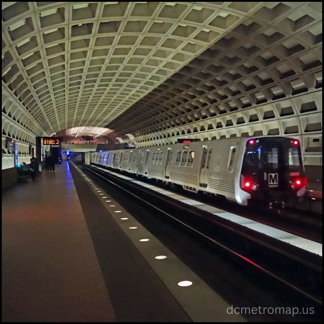
DC Metro Stops: DC Metro, officially Metrorail, is a critical rapid transit network in Washington D.C., Maryland, and Virginia. It is operated by the Washington Metropolitan Area Transit Authority (WMATA) and is the second busiest heavy rail transit system in the U.S. DC Metro stops can be found throughout the region, providing extensive coverage for both residents and visitors.

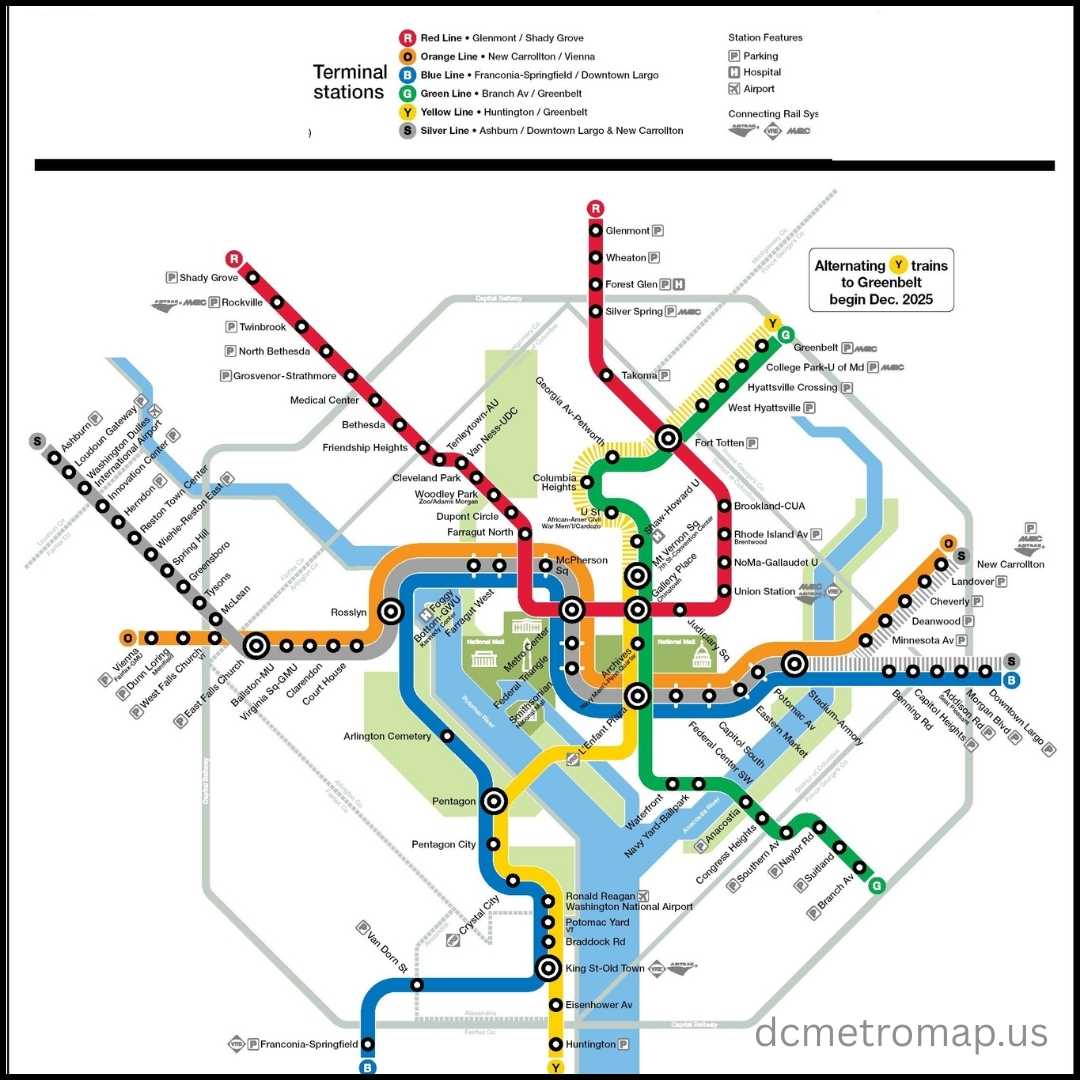
The network has six colour-coded lines – Red, Orange, Silver, Blue, Yellow, and Green – with 98 stations and 129 miles of rail. Several lines follow tracks downtown, offering easy access to main points of interest such as the National Mall, Smithsonian museums, and the Capitol. The Metro provides a convenient means for commuters and tourists alike to move about the busy metropolitan region.
You may also like:
Metro Stops in DC
Washington D.C. Metro (Metrorail) is a heavy transit system operating in D.C., Maryland, and Virginia with 98 stations on six colour-coded lines. Tracks are shared by lines downtown to make transfers easy to important locations like the National Mall and Smithsonian museums. Important DC metro stops are Metro Center, Gallery Place, and L’Enfant Plaza. It links to both DCA and IAD airports. Fares depend on distance and time of day and are paid with SmarTrip cards.
Washington DC Metro Stops Map
The Washington DC Metro stops map is a very recognisable and indispensable guide for getting around the metropolitan region. It’s a schematic map, or it favours simplicity and connectedness over exact geographic correctness, which is typical for the majority of subway maps globally.

Learning How to Use the Map for Navigation:
- Choose your origin station and destination station.
- Find them on the map.
- Decide which line you must take. If your beginning and ending points are on the same line, it’s a straight shot.
- If a transfer is required, take the transfer station where the lines cross. You may have to use stairs or an escalator because transfer lines can be on different levels.
- Observe the direction the train is headed (as denoted by the last stop of the line) to board the right-bound train.
DC Metro Silver Line Stops
The Silver Line of the Washington D.C. Metro connects Virginia’s western suburbs, including Dulles International Airport, to downtown D.C. and eastern Maryland. Known for its modern extensions, it enhances regional connectivity, offering better access for both commuters and travellers.
| Station Name | Type | Shared With |
|---|---|---|
| Ashburn | Exclusive | Western Terminus |
| Loudoun Gateway | Exclusive | – |
| Dulles International Airport | Exclusive | – |
| Innovation Center | Exclusive | – |
| Herndon | Exclusive | – |
| Reston Town Center | Exclusive | – |
| Wiehle–Reston East | Exclusive | – |
| Spring Hill | Exclusive | – |
| Greensboro | Exclusive | – |
| Tysons | Exclusive | – |
| McLean | Exclusive | – |
| East Falls Church | Shared | Orange Line |
| Ballston-MU | Shared | Orange Line |
| Virginia Square–GMU | Shared | Orange Line |
| Clarendon | Shared | Orange Line |
| Court House | Shared | Orange Line |
| Rosslyn | Shared | Blue, Orange Lines |
| Foggy Bottom–GWU | Shared | Blue, Orange Lines |
| Farragut West | Shared | Blue, Orange Lines |
| McPherson Square | Shared | Blue, Orange Lines |
| Metro Center | Shared | Red, Blue, Orange Lines |
| Federal Triangle | Shared | Blue, Orange Lines |
| Smithsonian | Shared | Blue, Orange Lines |
| L’Enfant Plaza | Shared | Blue, Green, Orange, Yellow Lines |
| Federal Center SW | Shared | Blue, Green, Orange, Yellow Lines |
| Capitol South | Shared | Blue, Green, Orange, Yellow Lines |
| Eastern Market | Shared | Blue, Green, Orange, Yellow Lines |
| Potomac Avenue | Shared | Blue, Green, Orange, Yellow Lines |
| Stadium–Armoury | Shared | Blue, Orange Lines |
| Benning Road | Shared | Blue Line |
| Capitol Heights | Shared | Blue Line |
| Addison Road | Shared | Blue Line |
| Morgan Boulevard | Shared | Blue Line |
| Downtown Largo | Shared | Blue Line (Eastern Blue/Silver Terminus) |
| New Carrollton | Shared | Orange Line (Eastern Orange/Silver Terminus) |
Hotels Near Washington DC Metro Stops
Washington DC metro stops include multiple hotels that are strategically placed close to the Metro station, making it easy to get to the city’s attractions. Choices vary from famous brands such as Hyatt Place Washington DC, etc. The suburbs and the city provide a wide variety of accommodation, ranging from luxurious stays to budget stays, all in strategically placed areas to take advantage of the Metrorail convenience. The range ensures proximity to popular destinations, business areas, and lively neighbourhoods.

| Hotel Name | Area | Nearby Metro Station(s) | Key Features |
|---|---|---|---|
| The Embassy Row Hotel | Dupont Circle | Dupont Circle | Rooftop pool, urban design |
| The Quincy | Downtown D.C. | Farragut North / Dupont Circle | Kitchenette rooms, budget-friendly |
| Hotel Hive | Foggy Bottom / Farragut | Foggy Bottom | Affordable, modern micro-hotel |
| DoubleTree by Hilton Silver Spring | Maryland / Virginia Suburbs | Silver Spring (Red Line) | National brand, walkable to Metro |
| Morrison Clark Inn | Downtown D.C. | Metro Center / Mt Vernon Sq | Historic Victorian mansion, sophisticated decor |
| Hampton Inn NoMa Union Station | NoMa / Union Market | NoMa-Gallaudet U | Free shuttle, hot breakfast |
| Pendry Washington DC – The Wharf | The Wharf | Waterfront | Upscale amenities, premium dining. |
| Kimpton George Hotel | Capitol Hill / Union Station | Union Station | 1 block from station, chic rooms |
| Country Inn & Suites at Branch Ave. | Maryland / Virginia Suburbs | Branch Ave. | Suburban setting, budget-friendly |
| Hyatt Centric Arlington | Arlington, VA (Suburbs) | Rosslyn | 2-min walk to Metro, quick commute to D.C. |
| Courtyard by Marriott Dunn Loring | Maryland / Virginia Suburbs | Dunn Loring (VA) | Free parking, families |
| The Dupont Circle Hotel | Dupont Circle | Dupont Circle | Chic, luxurious, great location |
| Hyatt Place Washington DC/National Mall | Downtown D.C. | Metro Center | Direct Metro access, upscale amenities |
| Hilton Washington DC Capitol Hill | Capitol Hill / Union Station | Union Station | Central location, some rooms with Capitol views |
| Canopy by Hilton Washington DC The Wharf | The Wharf | Waterfront | Waterfront views, modern decor |
| Holiday Inn Arlington at Ballston | Arlington, VA (Suburbs) | Ballston-MU | 4-star at lower cost, short Metro walk |
| The Ritz-Carlton, Washington, D.C. | Foggy Bottom / Farragut | Foggy Bottom | 5-star luxury, fine dining, spa |
| citizenM Washington DC NoMa | NoMa / Union Market | NoMa-Gallaudet U | Modern design, smart tech features |
| Hotel Lombardy | Foggy Bottom / Farragut | Farragut West | – |
Red Line Metro Stations
The Red Line runs in a “U” shape from Shady Grove to Glenmont through D.C. and Montgomery County, the oldest and busiest of the Washington Metro lines. It has 27 DC metro stops and operates on exclusive tracks. Union Station (Amtrak, MARC, VRE), Metro Center, and Gallery Place (transfers) are key DC metro stops, while Forest Glen and Wheaton feature deep platforms and long escalators.
| Station Name | Code | Rail Connections |
|---|---|---|
| Shady Grove | A15 | N/A |
| Rockville | A14 | Amtrak (Floridian), MARC (Brunswick Line) |
| Twinbrook | A13 | N/A |
| North Bethesda | A12 | N/A |
| Grosvenor–Strathmore | A11 | N/A |
| Medical Center | A10 | N/A |
| Bethesda | A09 | Planned MTA Purple Line |
| Friendship Heights | A08 | N/A |
| Tenleytown–AU | A07 | N/A |
| Van Ness–UDC | A06 | N/A |
| Cleveland Park | A05 | N/A |
| Woodley Park | A04 | N/A |
| Dupont Circle | A03 | N/A |
| Farragut North | A02 | N/A |
| Metro Center | A01 | Orange, Blue, Silver Lines (Metro transfer) |
| Gallery Place | B01 | Green, Yellow Lines (Metro transfer) |
| Judiciary Square | B02 | N/A |
| Union Station | B03 | Amtrak, MARC, VRE |
| NoMa–Gallaudet U | B35 | N/A |
| Rhode Island Avenue | B04 | N/A |
| Brookland–CUA | B05 | N/A |
| Fort Totten | B06 | N/A |
| Takoma | B07 | N/A |
| Silver Spring | B08 | Planned MTA Purple Line, MARC (Brunswick Line) |
| Forest Glen | B09 | N/A |
| Wheaton | B10 | N/A |
| Glenmont | B11 | N/A |
DC Metro Blue Line Stops
The DC Metro Blue Line, among the most utilized routes in the complex network run by the Washington Metropolitan Area Transit Authority, connects the Commonwealth of Virginia, the District of Columbia, and the State of Maryland. Extending from Franconia-Springfield in Virginia to Downtown Largo in Maryland, it incorporates 27 stations and supplies facile access to pivotal destinations, including Ronald Reagan National Airport, the Pentagon grounds, the National Mall, and Capitol Hill. Well-liked by both commuters hastily transferring and sightseers exploring the region, the Blue Line intersects with other Metro lines at pivotal transfer stations such as Rosslyn, Metro Center, and L’Enfant Plaza, providing users numerous options to reach their aims expeditiously. Offering benefit and connectivity within the regional infrastructure, it plays a key part in the transportation framework essential to the locale.
| Station No. | Station Name | Location (City/Area) |
|---|---|---|
| 1 | Franconia–Springfield | Springfield, VA |
| 2 | Van Dorn Street | Alexandria, VA |
| 3 | King St–Old Town | Alexandria, VA |
| 4 | Braddock Road | Alexandria, VA |
| 5 | National Airport (DCA) | Arlington, VA |
| 6 | Crystal City | Arlington, VA |
| 7 | Pentagon City | Arlington, VA |
| 8 | Pentagon | Arlington, VA |
| 9 | Arlington Cemetery | Arlington, VA |
| 10 | Rosslyn | Arlington, VA |
| 11 | Foggy Bottom–GWU | Washington, DC |
| 12 | Farragut West | Washington, DC |
| 13 | McPherson Square | Washington, DC |
| 14 | Metro Center | Washington, DC |
| 15 | Federal Triangle | Washington, DC |
| 16 | Smithsonian | Washington, DC |
| 17 | L’Enfant Plaza | Washington, DC |
| 18 | Federal Center SW | Washington, DC |
| 19 | Capitol South | Washington, DC |
| 20 | Eastern Market | Washington, DC |
| 21 | Potomac Avenue | Washington, DC |
| 22 | Stadium–Armory | Washington, DC |
| 23 | Benning Road | Washington, DC |
| 24 | Capitol Heights | Capitol Heights, MD |
| 25 | Addison Road–Seat Pleasant | Prince George’s County, MD |
| 26 | Morgan Boulevard | Prince George’s County, MD |
| 27 | Downtown Largo | Prince George’s County, MD |
Orange Line DC Metro Stops
| Stop Name | Location / Nearby Landmark | Key Connections |
|---|---|---|
| New Carrollton | Maryland – Major commuter hub | Amtrak, MARC, Metrobus |
| Landover | Landover, MD | Metrobus |
| Cheverly | Cheverly, MD | Metrobus |
| Deanwood | NE Washington, D.C. | Bus connections |
| Minnesota Avenue | NE Washington, D.C. | Metrobus |
| Stadium–Armory | Near RFK Stadium | Blue, Silver Lines |
| Potomac Avenue | Capitol Hill area | Metrobus |
| Eastern Market | Capitol Hill, near Eastern Market | Metrobus |
| Capitol South | Near U.S. Capitol | Metrobus |
| Federal Center SW | Near Smithsonian museums | Blue, Silver Lines |
| L’Enfant Plaza | Downtown DC | Yellow, Green, Blue, Silver Lines, VRE |
| Smithsonian | National Mall | Metrobus |
| Federal Triangle | Pennsylvania Avenue | Metrobus |
| Metro Center | Downtown hub | Red, Blue, Silver Lines |
| McPherson Square | Downtown DC | Blue, Silver Lines |
| Farragut West | Farragut Square | Blue, Silver Lines |
| Foggy Bottom–GWU | George Washington University | Metrobus |
| Rosslyn | Arlington, VA | Blue, Silver Lines |
| Court House | Arlington, VA | Metrobus |
| Clarendon | Arlington, VA | Metrobus |
| Virginia Square–GMU | Near George Mason University | Metrobus |
| Ballston–MU | Ballston neighborhood, Arlington | Metrobus |
| East Falls Church | Arlington, VA | Silver Line |
| West Falls Church | Falls Church, VA | Metrobus |
| Dunn Loring–Merrifield | Merrifield, VA | Metrobus |
| Vienna / Fairfax–GMU | Fairfax, VA – Line terminus | Metrobus |
Smithsonian Metro Stop, DC
Smithsonian Metro Station, located on the National Mall, is a key stop among various DC metro stops for tourists and locals, offering easy access to major museums and landmarks. It’s served by the Orange, Silver, and Blue Lines, providing strong connections across D.C., Virginia, and Maryland.
Weekday Schedule (Monday – Thursday)
| Rail Line | Destination | First Train | Last Train |
|---|---|---|---|
| Orange Line | Vienna | 5:20 AM | 11:47 PM |
| Orange Line | New Carrollton | 5:42 AM | 12:09 AM |
| Silver Line | Ashburn | 5:20 AM | 11:47 PM |
| Silver Line | Downtown Largo | 5:42 AM | 12:09 AM |
| Blue Line | Franconia-Springfield | 5:20 AM | 11:47 PM |
| Blue Line | Downtown Largo | 5:42 AM | 12:09 AM |
Weekend Schedule (Friday – Sunday)
| Rail Line | Destination | First Train | Last Train (Fri/Sat) | Last Train (Sunday) |
|---|---|---|---|---|
| Orange Line | Vienna | 6:21 AM | 1:47 AM | 11:47 PM |
| Orange Line | New Carrollton | 6:42 AM | 2:09 AM | 12:09 AM |
| Silver Line | Ashburn | 6:21 AM | 1:47 AM | 11:47 PM |
| Silver Line | Downtown Largo | 6:42 AM | 2:09 AM | 12:09 AM |
| Blue Line | Franconia-Springfield | 6:21 AM | 1:47 AM | 11:47 PM |
| Blue Line | Downtown Largo | 6:42 AM | 2:09 AM | 12:09 AM |
DC Zoo Metro Stop
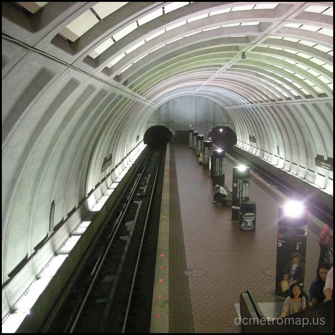
The Woodley Park-Zoo/Adams Morgan Metro station, also known as the “Woodley Park-Zoo”, is one of the major station among various DC metro stops and is situated on the Red Line in Northwest D.C. It gives easy access to the National Zoo and the Adams Morgan neighbourhood. The station has one center platform, Wi-Fi, and bike racks, but no on-street parking.

| Rail Line | Destination | First Train (Mon-Fri) | First Train (Sat/Sun) | Last Train (Mon-Thu) | Last Train (Fri/Sat) | Last Train (Sunday) |
|---|---|---|---|---|---|---|
| Red Line | Glenmont | 5:27 AM | 6:27 AM | 11:58 PM | 1:58 AM | 11:58 PM |
| Red Line | Shady Grove | 5:34 AM | 6:34 AM | 12:12 AM | 2:12 AM | 12:12 AM |
NoMa Metro Stop DC
NoMa-Gallaudet U Metro station, one of the DC metro stops, on the Red Line in Northeast D.C., serves the emerging NoMa neighbourhood, Gallaudet University, and Union Market. It provides direct access throughout D.C. and into Maryland, with a center platform and commuter-centric design.
| Rail Line | Destination | First Train (Mon-Fri) | First Train (Sat/Sun) | Last Train (Mon-Thu) | Last Train (Fri/Sat) | Last Train (Sun) |
|---|---|---|---|---|---|---|
| Red Line | Glenmont | 5:40 AM | 6:40 AM | 12:13 AM | 2:13 AM | 12:13 AM |
| Red Line | Shady Grove | 5:21 AM | 6:21 AM | 11:57 PM | 1:57 AM | 11:57 PM |
DC Metro Stops in Maryland
The Washington D.C. Metrorail system reaches into numerous DC metro stops in Maryland suburbs via the Red, Green, Orange, Silver, and Blue lines. These links provide vital transportation for commuters and facilitate easier access for Maryland residents to downtown D.C., government buildings, popular attractions, and other areas of the metro region.
| Station Name | Metro Line(s) Served | County |
|---|---|---|
| Addison Road | Blue, Silver | Prince George’s County |
| Bethesda | Red | Montgomery County |
| Branch Avenue | Green | Prince George’s County |
| Capitol Heights | Blue, Silver | Prince George’s County |
| Cheverly | Orange | Prince George’s County |
| College Park–University of Maryland | Green | Prince George’s County |
| Downtown Largo | Blue, Silver | Prince George’s County |
| Forest Glen | Red | Montgomery County |
| Glenmont | Red | Montgomery County |
| Greenbelt | Green | Prince George’s County |
| Grosvenor–Strathmore | Red | Montgomery County |
| Hyattsville Crossing | Green | Prince George’s County |
| Landover | Orange | Prince George’s County |
| Medical Center | Red | Montgomery County |
| Morgan Boulevard | Blue, Silver | Prince George’s County |
| Naylor Road | Green | Prince George’s County |
| New Carrollton | Orange | Prince George’s County |
| North Bethesda | Red | Montgomery County |
| Rockville | Red | Montgomery County |
| Silver Spring | Red | Montgomery County |
| Southern Avenue | Green | Prince George’s County |
| Suitland | Green | Prince George’s County |
| Twinbrook | Red | Montgomery County |
| West Hyattsville | Green | Prince George’s County |
| Wheaton | Red | Montgomery County |
DC Metro Stops with Parking
Most DC Metro stations also provide parking, allowing folks to park their cars and ride in. These Metro stops further facilitate avoiding traffic creeping into our already congested downtown streets while providing affordable overnight parking rates ($5-$6 on weekdays and free on weekends and federal holidays). With SmarTrip® cards, payment is fast and easy.
| Metro Station | Line(s) Served | Parking Type | Daily Rate* |
|---|---|---|---|
| Shady Grove | Red Line | Garage/Lot | ~$5.20 |
| Vienna/Fairfax–GMU | Orange Line | Garage/Lot | ~$5.20 |
| Franconia–Springfield | Blue Line | Garage/Lot | ~$5.20 |
| Greenbelt | Green/Yellow Line | Garage/Lot | ~$5.20 |
| Wiehle–Reston East | Silver Line | Garage | ~$4.95 |
Frequently Asked Questions
1. What are the nearest DC Metro stops to the Washington D.C. National Zoo?
The closest DC Metro stops near Metro station to the National Zoo is Woodley Park-Zoo/Adams Morgan on the Red Line. It’s a 10-15 minute walk, uphill, from the station to the zoo gate. Alternatively, Cleveland Park station (also Red Line) is a longer but more level walk.
2. Which DC Metro stops serve Metro Center in Washington?
Metro Center is a large transfer station in downtown Washington, D.C. The station serves four lines: Red, Orange, Silver, and Blue. It is the perfect central station to change between lines and reach the downtown attractions of the city.
3. At what time does the D.C. Metro close?
The D.C. Metro usually closes about midnight Sunday to Thursday, and about 1 a.m. Fridays and Saturdays. Last train times are slightly different by line and station, so it’s always best to consult WMATA’s trip planner for precise schedules.
4. What D.C. Metro stations have parking?
Several DC Metro stops in the Maryland and Virginia suburbs offer parking, including Shady Grove, Greenbelt, Vienna, and Franconia-Springfield. Yet most DC metro stops within city limits do not have parking facilities, instead prioritising bus and pedestrian entry.
5. What are the major Blue Line DC Metro stops?
The Blue Line operates from Franconia-Springfield in Virginia to Downtown Largo in Maryland. The important DC metro stops are the Pentagon, Smithsonian, L’Enfant Plaza, Metro Center, and Capitol South, which provide access to attractions and transfer points with other lines.
